FAKENHAM LANCASTER HERITAGE TRAIL
  • Home
  • Plaque List
    • 01 Market Place
    • 02 The Crown
    • 03 The Red Lion
    • 04 Norwich Street
    • 05 Corn Exchange
    • 06 Aldiss
    • 07 St Peter & St Paul Church
    • 08 Banks
    • 09 Peckover Family
    • 10 The Manor House
    • 11 Cromwell Cottage
    • 12 Fakenham Mill
    • 13 Museum of Gas & Local History
    • 14 The Cattle Market
    • 15 White Horse Street
    • 16 Quaker Burial Ground
    • 17 British School
    • 18 Fakenham Town Sign
    • 19 Junior School
    • 20 Queens Road Cemetery
    • 21 The Star
    • 22 The Methodist Church
    • 23 The Old Rectory
    • 24 Salvation Army Temple
    • 25 Old Post Office
    • 26 The Old Fire Station
    • 27 Hall Staithe
    • 28 Goggs' Mill
    • 29 Fakenham West Railway Station
    • 30 Three Brick Arches
    • 31 Fakenham East Station
    • 32 Fakenham Racecourse
  • History
  • Trail Map

12. FAKENHAM MILL

12. FAKENHAM MILL


Fakenham Mill was built in about 1720 on the site of an older mill dating from 1620. There are records going back to before 1240 when Brige's Mill, here at the Fakenham end of the Hempton causeway, was leased by the Prior of Castle Acre to Hempton Priory.

​Over the succeeding centuries there were many disputes, both physical and legal, between the two villages about the water level in the water meadows. A higher level meant flooded meadows and less grazing but ensured an increased income for the Priory from causeway fees.


The River Wensum’s course was altered away from Hall Staithe in order to increase the efficiency of the 1620 mill. At some points the river is higher than Hempton Road and this was indeed flooded in 1912.

The new cut is shown on a 1650 map. The mill had to run in conjunction with Sculthorpe and Goggs' Mills upstream as they controlled the river flow. The wheel, in a cast iron frame was 10 feet in diameter and powered 4 pairs of stones as well as the ancillary machinery. The river was much wider then.

Early in the 20th century steam was being used to supplement water power and a tall chimney was built on the end of the steam shed. The chimney could be seen for some considerable distance.
Picture
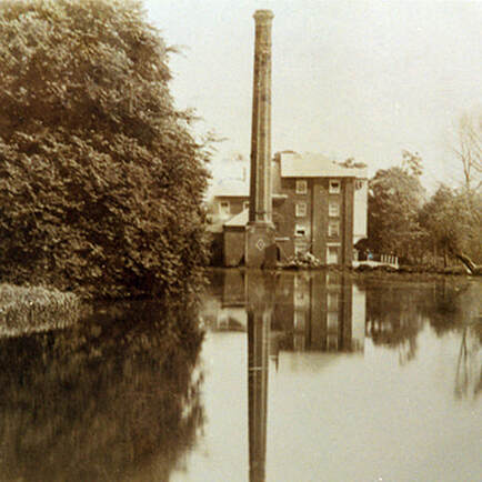
A view from the river Wensum showing the chimney built in the era of steam.
Picture
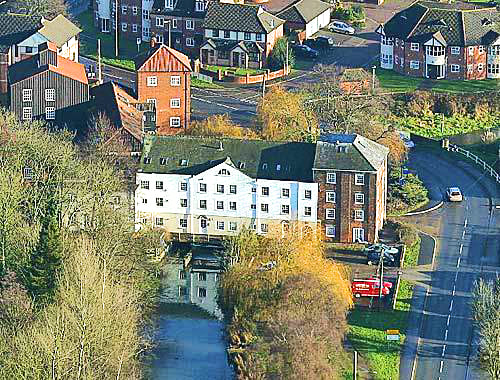
Fakeham Mill as it looks today, taken from the air. Now coverted into apartments.


The next Plaque is on the other side of the road.
Picture
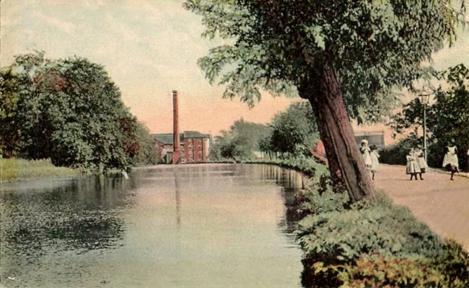
A view of Fakenham Mill dating from around 1912. A gasometer can be seen behind the girls.
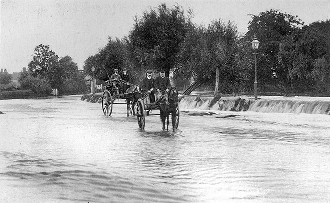
Picture
The floods of 1912.
Picture
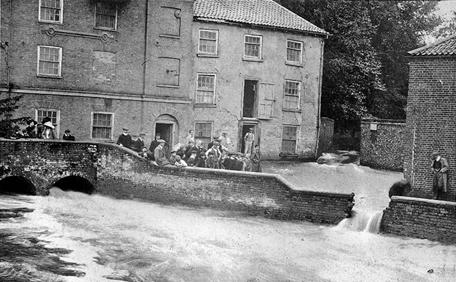
The wall was breached to release the flood water.
Picture
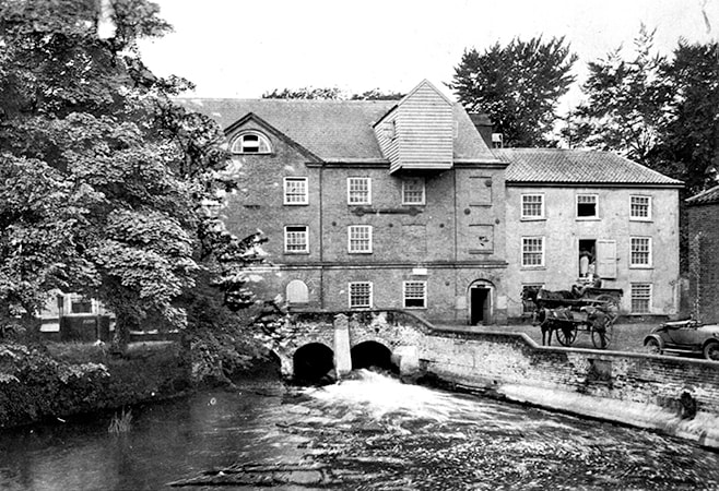
The Mill's normal water level.
Picture
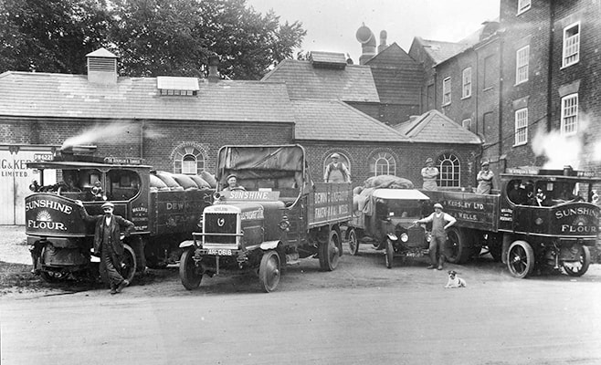
Dewing & Kersley’s steam and petrol lorries at the mill.

AUDIO - Click to Play

Picture

VIDEO - Click to Play

Picture
HOME        PLAQUE LIST         HISTORY        TRAIL MAP
Proudly powered by Weebly
  • Home
  • Plaque List
    • 01 Market Place
    • 02 The Crown
    • 03 The Red Lion
    • 04 Norwich Street
    • 05 Corn Exchange
    • 06 Aldiss
    • 07 St Peter & St Paul Church
    • 08 Banks
    • 09 Peckover Family
    • 10 The Manor House
    • 11 Cromwell Cottage
    • 12 Fakenham Mill
    • 13 Museum of Gas & Local History
    • 14 The Cattle Market
    • 15 White Horse Street
    • 16 Quaker Burial Ground
    • 17 British School
    • 18 Fakenham Town Sign
    • 19 Junior School
    • 20 Queens Road Cemetery
    • 21 The Star
    • 22 The Methodist Church
    • 23 The Old Rectory
    • 24 Salvation Army Temple
    • 25 Old Post Office
    • 26 The Old Fire Station
    • 27 Hall Staithe
    • 28 Goggs' Mill
    • 29 Fakenham West Railway Station
    • 30 Three Brick Arches
    • 31 Fakenham East Station
    • 32 Fakenham Racecourse
  • History
  • Trail Map