ON MOBILE DEVICES AND TABLETS ROTATE YOUR DEVICE TO VIEW MAP ABOVE LARGER
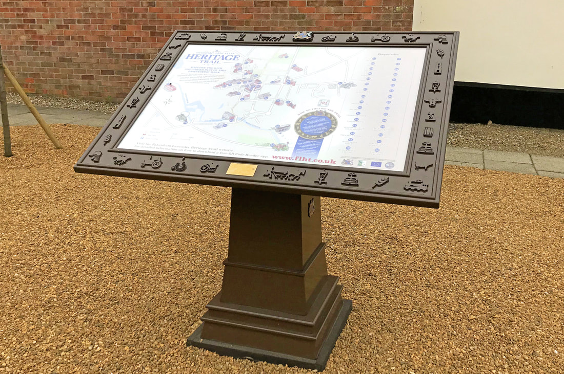
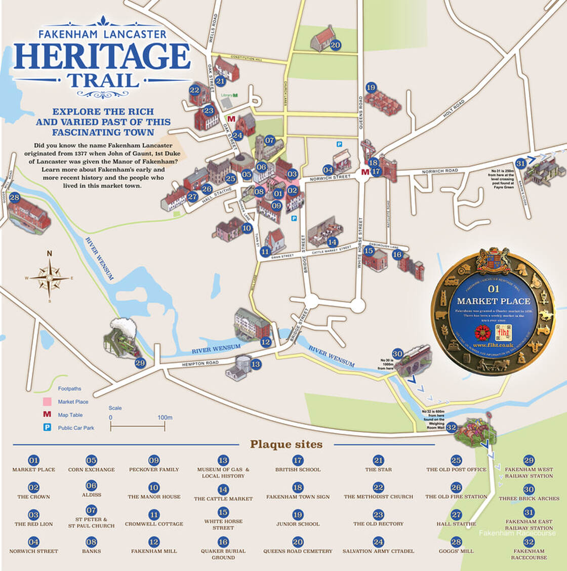
Map Stand 1 is outside the main Library
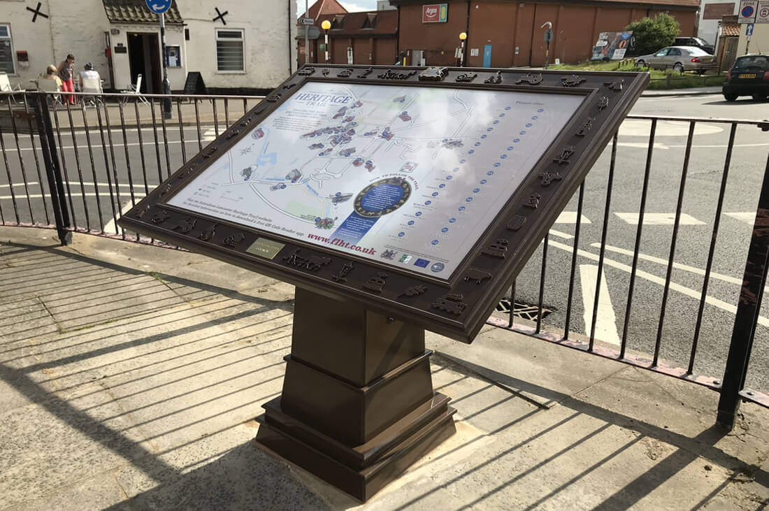
Map Stand 2 is at the Town Sign by the mini-roundabout where the Norwich and Holt roads meet.

|
HERITAGE TRAIL MAP LOCATIONSThe Trail Map Stands are located in two central positions in the town.
Take a look at the map above and you will see both Map locations marked with a red M The Library Map M point is the starting point. Map Stand 1; Outside The Library Map Stand 2; In front of the Old Town Sign at the mini-roundabout where the Norwich and Holt roads meet. How long does the Trail take to complete? As a rough guide, the first 28 sites form a mostly paved trail covering approximately 1.5 miles and takes about 1.5 hours. The only rough surface is in Ratcliffe Road between 16 & 17 and this can be avoided by using White Horse Street. Constitution Hill between 20 & 21 is steep and can be avoided by using Church Lanes to walk back from the cemetery to the Market Place. Sites from 27-32 are out of the central town area and vary in distance from between 1 and 3 miles from the Library start point. "Step back in time and discover our diverse industrious past, detailing the people and communities who helped create the
|
A 40 page Booklet will also be available in March 2022 featuring the full story of the Fakenham Heritage Trail sites. Available from Paper-Klip in Bridge Street.
|
Comments and Feedback
We welcome your comments and any feedback, you may wish to make on Fakenham Lancaster's Heritage Trail.
Please email us using [email protected]
We welcome your comments and any feedback, you may wish to make on Fakenham Lancaster's Heritage Trail.
Please email us using [email protected]